| 0200054247 | 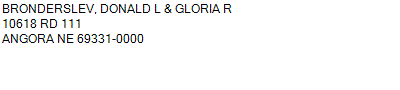 S1/2SW
24-20-48
80.000 ACRES | S1/2SW
24-20-48
80.000 ACRES |
| 0200054247 | S1/2SW
24-20-48
80.000 ACRES |
- Payment Information
-
Select which payment(s) you would like to make and click on continue.
- Deliquency Dates
-
1st Half: 05/01/2013
-
2nd Half: 09/01/2013
| Tax District | 265 | Gross Tax Assessed | $ 283.02 |
| Levy | 0.00000000 | Exemption/Credit | $ 12.54 |
| Value | $ 17,520 | Net Tax | $ 270.48 |
| Tax Sale(s) | | | |
| Statement Number | 2012-832 (RE) |
| Tax District | 265 |
| Levy | 0.00000000 |
| Value | $ 17,520 |
| Gross Tax Assessed | $ 283.02 |
| Exemption/Credit | $ 12.54 |
| Net Tax | $ 270.48 |
| Tax Sale(s) | |
| Net Tax Due | $ 270.48 | |
| First Payment | $ 0.00 | Receipt Date 3/5/2014 |
| Second Payment | $ 0.00 | Receipt Date 3/5/2014 |
| Unpaid Tax Due | $ 0.00 | |
| Net Tax Due | $ 270.48 | |
| First Payment | $ 0.00 | Receipt Date 3/5/2014 |
| Second Payment | $ 0.00 | Receipt Date 3/5/2014 |
| Unpaid Tax Due | $ 0.00 | |
Receipt date is the business date the payment was posted, not the date received from the taxpayer.