| 0200038187 | 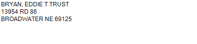 S1/2N1/2 S1/2
25-19-47
480.000 ACRES | S1/2N1/2 S1/2
25-19-47
480.000 ACRES |
| 0200038187 | S1/2N1/2 S1/2
25-19-47
480.000 ACRES |
- Payment Information
-
Select which payment(s) you would like to make and click on continue.
- Deliquency Dates
-
1st Half: 05/01/2013
-
2nd Half: 09/01/2013
| Tax District | 190 | Gross Tax Assessed | $ 2,437.52 |
| Levy | 0.00000000 | Exemption/Credit | $ 128.52 |
| Value | $ 179,755 | Net Tax | $ 2,309.00 |
| Tax Sale(s) | | | |
| Statement Number | 2012-886 (RE) |
| Tax District | 190 |
| Levy | 0.00000000 |
| Value | $ 179,755 |
| Gross Tax Assessed | $ 2,437.52 |
| Exemption/Credit | $ 128.52 |
| Net Tax | $ 2,309.00 |
| Tax Sale(s) | |
| Net Tax Due | $ 2,309.00 | |
| First Payment | $ 0.00 | Receipt Date 5/10/2013 |
| Second Payment | $ 0.00 | Receipt Date 5/10/2013 |
| Unpaid Tax Due | $ 0.00 | |
| Net Tax Due | $ 2,309.00 | |
| First Payment | $ 0.00 | Receipt Date 5/10/2013 |
| Second Payment | $ 0.00 | Receipt Date 5/10/2013 |
| Unpaid Tax Due | $ 0.00 | |
Receipt date is the business date the payment was posted, not the date received from the taxpayer.