| 0200033185 | 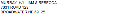 S1/2NE, N1/2SE
28-18-48
156.360 ACRES | S1/2NE, N1/2SE
28-18-48
156.360 ACRES |
| 0200033185 | S1/2NE, N1/2SE
28-18-48
156.360 ACRES |
- Payment Information
-
Select which payment(s) you would like to make and click on continue.
- Deliquency Dates
-
1st Half: 05/01/2024
-
2nd Half: 09/01/2024
| Tax District | 45 | Gross Tax Assessed | $ 3,079.68 |
| Levy | 1.44348600 | Exemption/Credit | $ 251.08 |
| Value | $ 213,350 | Net Tax | $ 2,828.60 |
| Tax Sale(s) | | | |
| Statement Number | 2023-4685 (RE) |
| Tax District | 45 |
| Levy | 1.44348600 |
| Value | $ 213,350 |
| Gross Tax Assessed | $ 3,079.68 |
| Exemption/Credit | $ 251.08 |
| Net Tax | $ 2,828.60 |
| Tax Sale(s) | |
| Net Tax Due | $ 2,828.60 | |
| First Payment | $ 0.00 | Receipt Date 4/30/2024 |
| Second Payment | $ 1,414.30 | Pay Second Half |
| Unpaid Tax Due | $ 1,414.30 | |
| Net Tax Due | $ 2,828.60 | |
| First Payment | $ 0.00 | Receipt Date 4/30/2024 |
| Second Payment | $ 1,414.30 | Pay Second Half |
| Unpaid Tax Due | $ 1,414.30 | |
Receipt date is the business date the payment was posted, not the date received from the taxpayer.