| 0200035455 | 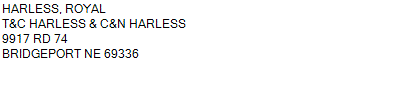 S1/2NE, S1/2NW, NENE
30-18-50
199.190 ACRES | S1/2NE, S1/2NW, NENE
30-18-50
199.190 ACRES |
| 0200035455 | S1/2NE, S1/2NW, NENE
30-18-50
199.190 ACRES |
- Payment Information
-
Select which payment(s) you would like to make and click on continue.
- Deliquency Dates
-
1st Half: 05/01/2019
-
2nd Half: 09/01/2019
| Tax District | 225 | Gross Tax Assessed | $ 1,378.06 |
| Levy | 0.00000000 | Exemption/Credit | $ 84.84 |
| Value | $ 81,725 | Net Tax | $ 1,293.22 |
| Tax Sale(s) | | | |
| Statement Number | 2018-2651 (RE) |
| Tax District | 225 |
| Levy | 0.00000000 |
| Value | $ 81,725 |
| Gross Tax Assessed | $ 1,378.06 |
| Exemption/Credit | $ 84.84 |
| Net Tax | $ 1,293.22 |
| Tax Sale(s) | |
| Net Tax Due | $ 1,293.22 | |
| First Payment | $ 0.00 | Receipt Date 5/22/2019 |
| Second Payment | $ 0.00 | Receipt Date 9/24/2019 |
| Unpaid Tax Due | $ 0.00 | |
| Net Tax Due | $ 1,293.22 | |
| First Payment | $ 0.00 | Receipt Date 5/22/2019 |
| Second Payment | $ 0.00 | Receipt Date 9/24/2019 |
| Unpaid Tax Due | $ 0.00 | |
Receipt date is the business date the payment was posted, not the date received from the taxpayer.