| 0200163429 | 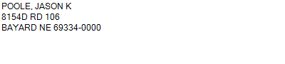 PT W1/2W1/2SE (MH)
8154D RD 106 BAYARD NE 69334
29-21-51
1.280 ACRES | PT W1/2W1/2SE (MH)
8154D RD 106 BAYARD NE 69334
29-21-51
1.280 ACRES |
| 0200163429 | PT W1/2W1/2SE (MH)
8154D RD 106 BAYARD NE 69334
29-21-51
1.280 ACRES |
- Payment Information
-
Select which payment(s) you would like to make and click on continue.
- Deliquency Dates
-
1st Half: 05/01/2019
-
2nd Half: 09/01/2019
| Tax District | 105 | Gross Tax Assessed | $ 254.44 |
| Levy | 0.00000000 | Exemption/Credit | $ 12.98 |
| Value | $ 14,965 | Net Tax | $ 241.46 |
| Tax Sale(s) | | | |
| Statement Number | 2018-5197 (RE) |
| Tax District | 105 |
| Levy | 0.00000000 |
| Value | $ 14,965 |
| Gross Tax Assessed | $ 254.44 |
| Exemption/Credit | $ 12.98 |
| Net Tax | $ 241.46 |
| Tax Sale(s) | |
| Net Tax Due | $ 241.46 | |
| First Payment | $ 0.00 | Receipt Date 10/15/2019 |
| Second Payment | $ 0.00 | Receipt Date 10/15/2019 |
| Unpaid Tax Due | $ 0.00 | |
| Net Tax Due | $ 241.46 | |
| First Payment | $ 0.00 | Receipt Date 10/15/2019 |
| Second Payment | $ 0.00 | Receipt Date 10/15/2019 |
| Unpaid Tax Due | $ 0.00 | |
Receipt date is the business date the payment was posted, not the date received from the taxpayer.