| 0200035978 | 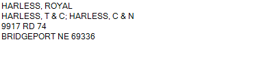 NW
13-18-51
160.000 ACRES | NW
13-18-51
160.000 ACRES |
| 0200035978 | NW
13-18-51
160.000 ACRES |
- Payment Information
-
Select which payment(s) you would like to make and click on continue.
- Deliquency Dates
-
1st Half: 05/01/2014
-
2nd Half: 09/01/2014
| Tax District | 270 | Gross Tax Assessed | $ 852.76 |
| Levy | 0.00000000 | Exemption/Credit | $ 36.72 |
| Value | $ 55,645 | Net Tax | $ 816.04 |
| Tax Sale(s) | | | |
| Statement Number | 2013-2728 (RE) |
| Tax District | 270 |
| Levy | 0.00000000 |
| Value | $ 55,645 |
| Gross Tax Assessed | $ 852.76 |
| Exemption/Credit | $ 36.72 |
| Net Tax | $ 816.04 |
| Tax Sale(s) | |
| Net Tax Due | $ 816.04 | |
| First Payment | $ 0.00 | Receipt Date 5/13/2014 |
| Second Payment | $ 0.00 | Receipt Date 9/11/2014 |
| Unpaid Tax Due | $ 0.00 | |
| Net Tax Due | $ 816.04 | |
| First Payment | $ 0.00 | Receipt Date 5/13/2014 |
| Second Payment | $ 0.00 | Receipt Date 9/11/2014 |
| Unpaid Tax Due | $ 0.00 | |
Receipt date is the business date the payment was posted, not the date received from the taxpayer.