| 0200071923 | 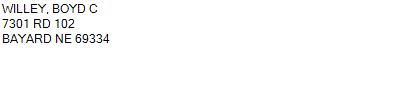 PT NE (N OF RR)
7-20-52
57.470 ACRES | PT NE (N OF RR)
7-20-52
57.470 ACRES |
| 0200071923 | PT NE (N OF RR)
7-20-52
57.470 ACRES |
- Payment Information
-
Select which payment(s) you would like to make and click on continue.
- Deliquency Dates
-
1st Half: 05/01/2023
-
2nd Half: 09/01/2023
| Tax District | 105 | Gross Tax Assessed | $ 647.58 |
| Levy | 1.74100500 | Exemption/Credit | $ 47.58 |
| Value | $ 37,195 | Net Tax | $ 600.00 |
| Tax Sale(s) | | | |
| Statement Number | 2022-6988 (RE) |
| Tax District | 105 |
| Levy | 1.74100500 |
| Value | $ 37,195 |
| Gross Tax Assessed | $ 647.58 |
| Exemption/Credit | $ 47.58 |
| Net Tax | $ 600.00 |
| Tax Sale(s) | |
| Net Tax Due | $ 600.00 | |
| First Payment | $ 0.00 | Receipt Date 12/22/2023 |
| Second Payment | $ 0.00 | Receipt Date 12/22/2023 |
| Unpaid Tax Due | $ 0.00 | |
| Net Tax Due | $ 600.00 | |
| First Payment | $ 0.00 | Receipt Date 12/22/2023 |
| Second Payment | $ 0.00 | Receipt Date 12/22/2023 |
| Unpaid Tax Due | $ 0.00 | |
Receipt date is the business date the payment was posted, not the date received from the taxpayer.