| 0200034009 | 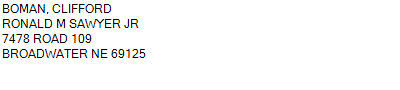 ALL
7478 ROAD 109 BROADWATER NE 69336
18-18-49
621.210 ACRES | ALL
7478 ROAD 109 BROADWATER NE 69336
18-18-49
621.210 ACRES |
| 0200034009 | ALL
7478 ROAD 109 BROADWATER NE 69336
18-18-49
621.210 ACRES |
- Payment Information
-
Select which payment(s) you would like to make and click on continue.
- Deliquency Dates
-
1st Half: 05/01/2023
-
2nd Half: 09/01/2023
| Tax District | 220 | Gross Tax Assessed | $ 4,975.92 |
| Levy | 1.71423800 | Exemption/Credit | $ 362.78 |
| Value | $ 290,270 | Net Tax | $ 4,613.14 |
| Tax Sale(s) | 24-023 | | |
| Statement Number | 2022-749 (RE) |
| Tax District | 220 |
| Levy | 1.71423800 |
| Value | $ 290,270 |
| Gross Tax Assessed | $ 4,975.92 |
| Exemption/Credit | $ 362.78 |
| Net Tax | $ 4,613.14 |
| Tax Sale(s) | 24-023 |
| Net Tax Due | $ 4,613.14 | |
| First Payment | $ 0.00 | Receipt Date 3/4/2024 |
| Second Payment | $ 0.00 | Receipt Date 3/4/2024 |
| Unpaid Tax Due | $ 0.00 | |
| Net Tax Due | $ 4,613.14 | |
| First Payment | $ 0.00 | Receipt Date 3/4/2024 |
| Second Payment | $ 0.00 | Receipt Date 3/4/2024 |
| Unpaid Tax Due | $ 0.00 | |
Receipt date is the business date the payment was posted, not the date received from the taxpayer.
The following conditions prevent you from paying your taxes online.
- There is a tax sale on this parcel.